
Designed for Applications
Tutorial Video: (Link coming early 2026)
Get NetMap Virtual Watersheds and Tools
Terrainworks provides a scalable solution for watershed projects and planning at any scale, from a single resource development activity of tens to hundreds of acres to entire watersheds of hundreds of thousands of acres.
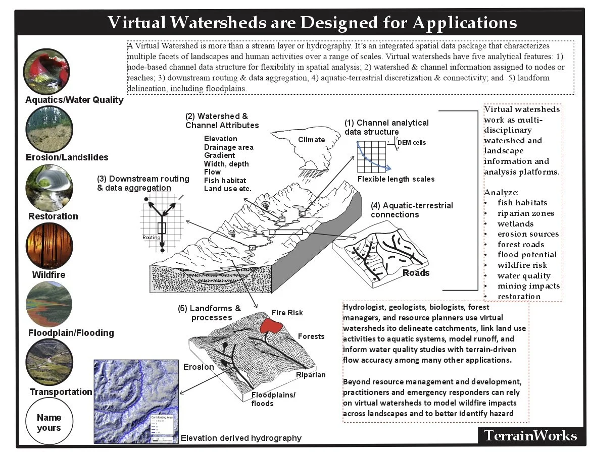
NetMap Virtual Watershed datasets contain numerous channel and watershed attributes to support resource management planning and review, and management, restoration and research. Our datasets provide information not available anywhere and they are designed to save you time and money.
Our datasets are built using the highest resolution digital elevation data, ranging from LiDAR to 10 m DEMs (IfSAR 5 m or LiDAR in Alaska).

Watershed Data Categories and Tools
Channel environments
Floodplains
Aquatic habitats (fish, beaver)
Riparian attributes
Erosion susceptibility
Road attributes
Wildfire/climate change
Analysis tools
Virtual watersheds contain “smart River networks” that are routed and contain key channel and watershed information; see our free river networks.
To access our existing full virtual watersheds or to order new ones, contact us.
There is analytical power at your fingertips when using Terrainworks’ virtual watersheds with tools.
Identify fish habitats and floodplains


Use virtual watersheds & tools to search locations for the placement of new optimized road drains to reduce erosion and sediment delivery to streams.
Identify channels and floodplain areas in need of habitat restoration


NetMap geospatial tools that work within virtual watersheds are available in two versions:
Arc Pro
Arc Map
Contact Us for further information.